The Wrecks – Gozo
Jump to: Karwela · Cominoland · Hephaestus
MV Karwela
Constructed in West Germany in 1957 as a high-frequency car and passenger ferry originally named Carl Arp. Acquired by the Gozo Channel Company in 1979 and renamed Karwela (Maltese for "Caravel"), serving the primary inter-island channel route for over 20 years. Decommissioned in 2005 and scuttled on August 12, 2006, alongside its sister ferry, the MV Xlendi.
Points of Entry& Exploration PathsForedeck and upper railings sit at 20–26m. The iconic interior staircase spans 25–32m. The main vehicle deck leads to the lower engine room entry at 34–38m. The massive hull and bow rest on the sand at 28–40m.
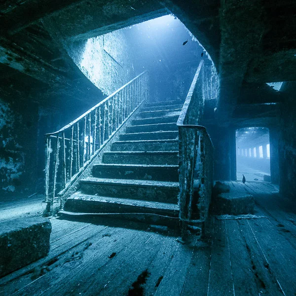
Points of Interest& Unique FactsFeatures a remarkably preserved, deeply symmetrical interior passenger staircase that has become the single most photographed structural wreck feature in Gozo. The vessel was scuttled with its original paint layer fully intact to monitor chemical and biological substrate reactions over time.
Marine Life NotesThe foredeck and upper railings are densely carpeted in delicate sea fans, hosting vibrant swirling clouds of damselfish and chromis. Massive groupers regularly guard the shadow of the deep bow.
MV Cominoland
Built in England in 1942 by Philip and Son Ltd as Miner VI (M6), an M-class military minelayer for WWII harbor defense. Sold and converted to a civilian ferry in 1966, operating as Minor IV and MV Minor Eagle. Redesignated MV Cominoland in 1976 for the Valletta–Comino tourism route. Briefly named MV Jylland II in 1980 before reverting back in 1982. Deliberately scuttled on August 12, 2006, simultaneously with the Karwela.
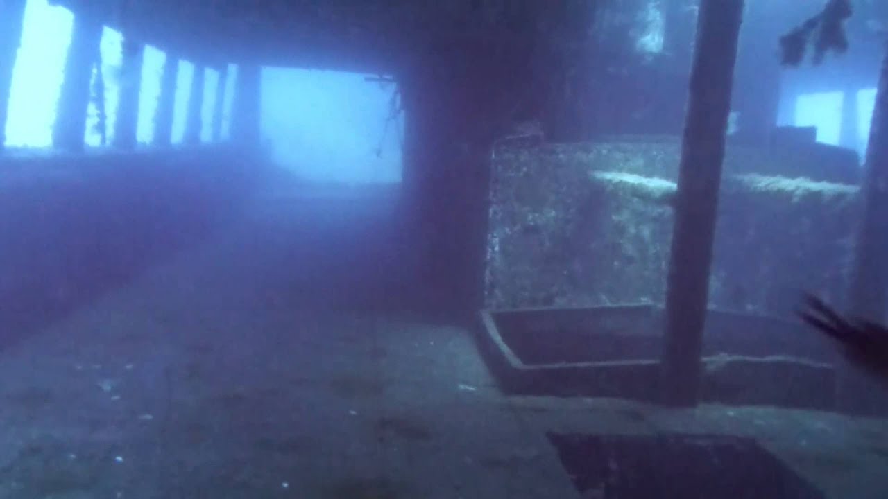
Points of Entry& Exploration PathsSuperstructure starts at 32m. Two full decks are widely open for simple, linear penetration paths from 35–42m, with generous exit openings cut out. The deep bow and keel rest on the sand at 38–45m.
Points of Interest& Unique FactsBefore scuttling, all paint was completely stripped from the hull down to the bare metal. This serves as a direct scientific comparison to the Karwela (which kept its paint), proving that bare metal encourages a vastly different, denser trajectory of sponge and invertebrate colonisation.
Marine Life NotesBecause of the stripped hull chemistry, it features an incredibly thick, colorful blanket of encrusting sponges and bryozoans. Large groupers are common around the deep keel.
MV Hephaestus
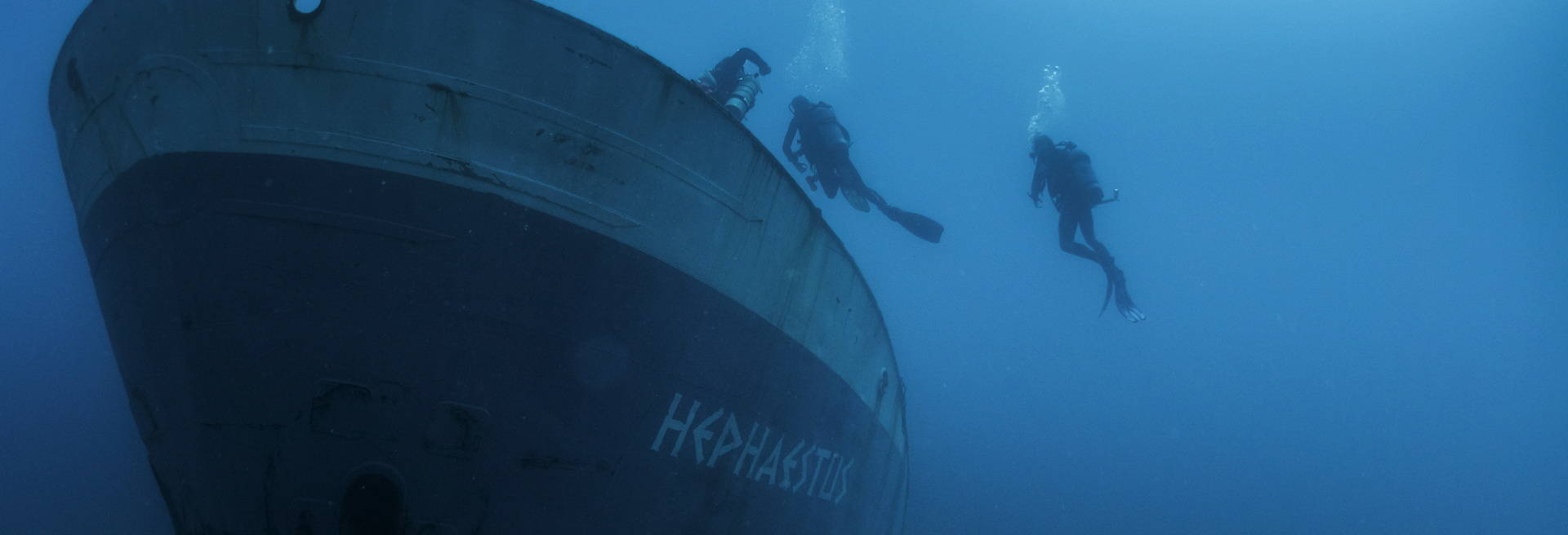
Operated as a 60-meter commercial oil tanker hauling bulk petroleum products across the central Mediterranean under the Maltese flag. During a violent storm in 2018, the vessel ran hard aground on the rocky coastline of Qawra. Following a complex 4-year environmental decontamination and stripping program, it was deliberately scuttled at Xatt l-Ahmar on August 29, 2022.
Points of Interest& Unique FactsMalta's newest major wreck and the final addition to the famous Xatt l-Ahmar 4-Wreck Cluster.