The Wrecks – Malta
Malta hosts some of the Mediterranean's most accessible and historically rich shore-dive wrecks. Jump to a wreck: Um El Faroud . P29 · Rozi.
Um El Faroud
 Chronological History
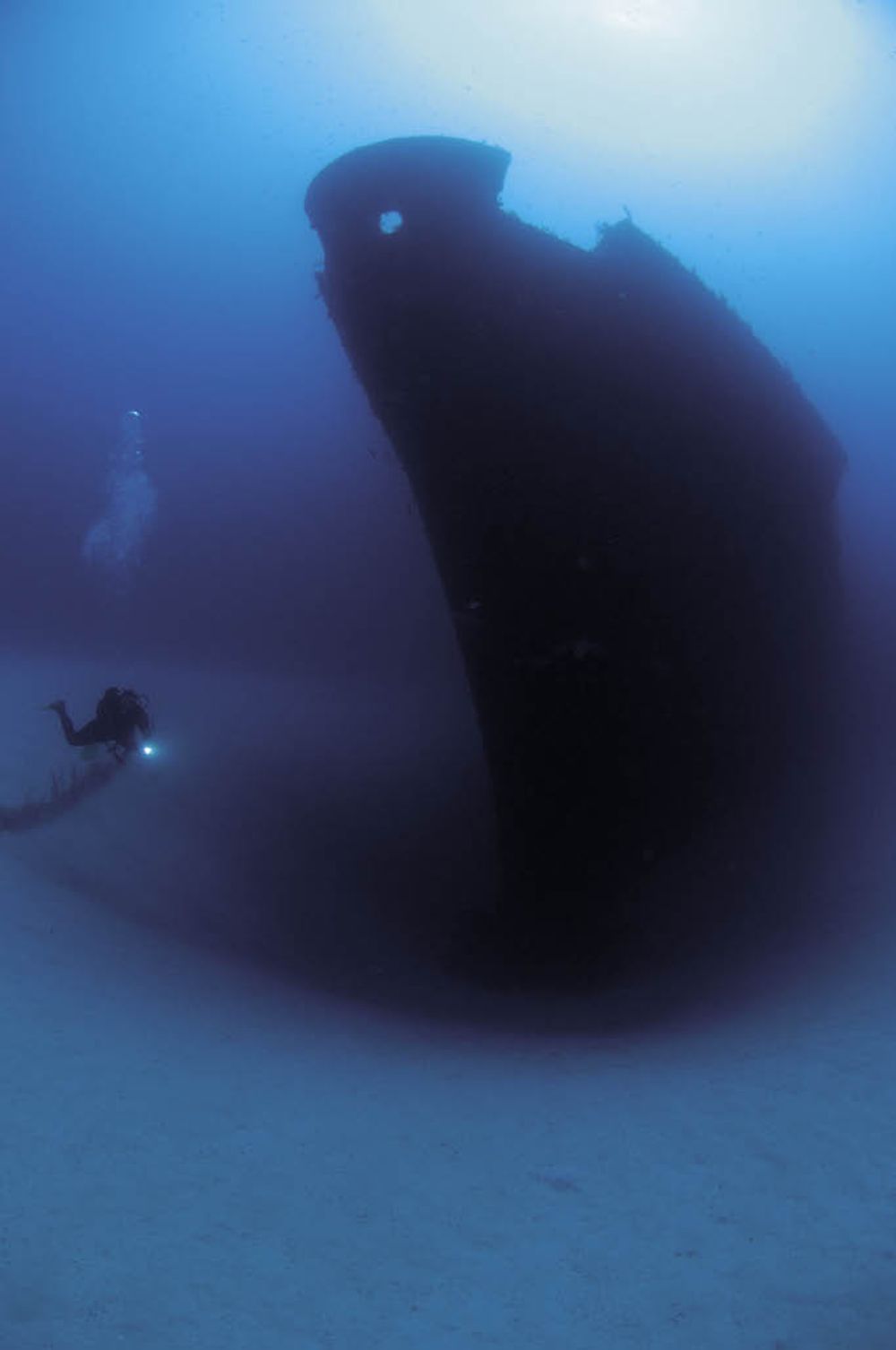
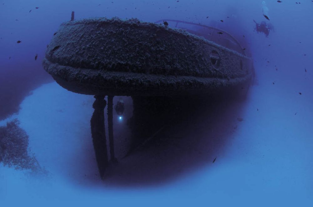
Built in Newcastle, UK, in 1969. A massive 109-meter Libyan-owned oil tanker that operated across the Mediterranean for nearly three decades. In 1995, during catastrophic maintenance work in Valletta's Grand Harbour, a gas explosion killed nine shipyard workers and structurally compromised the hull. Following decontamination, it was scuttled as an artificial reef on September 2, 1998. Severe winter storms between 2005 and 2006 ripped the ship cleanly into two distinct halves.
Marine Life NotesThe horizontal funnel acts as a magnet for massive moray eels and sweeping schools of damselfish. Large groupers regularly use the dark corners of the engine room as hunting blinds.
Um El Faroud — Dive 1: The Funnel & Midship
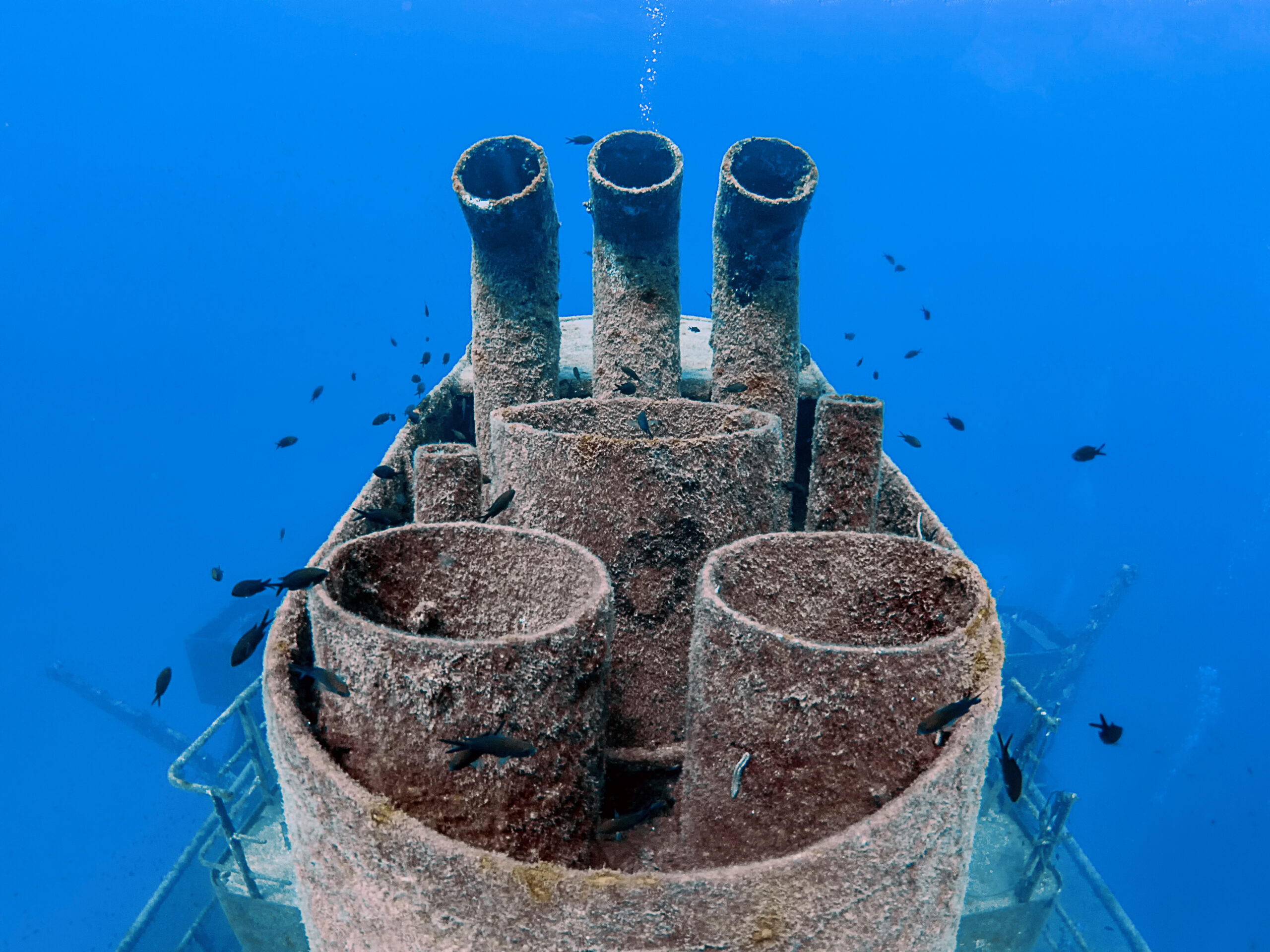
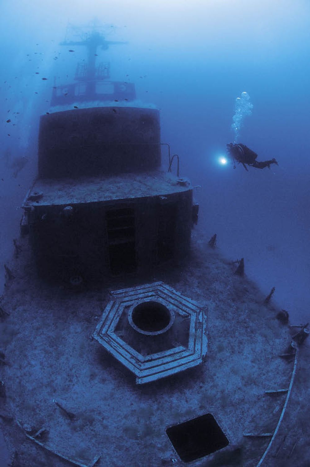
Focuses on the midsection. Explores the main funnel structure starting at 22m. The funnel was knocked sideways by storms and now rests horizontally, heavily encrusted with brilliant orange and yellow sponges.
Um El Faroud — Dive 2: Stern Propeller
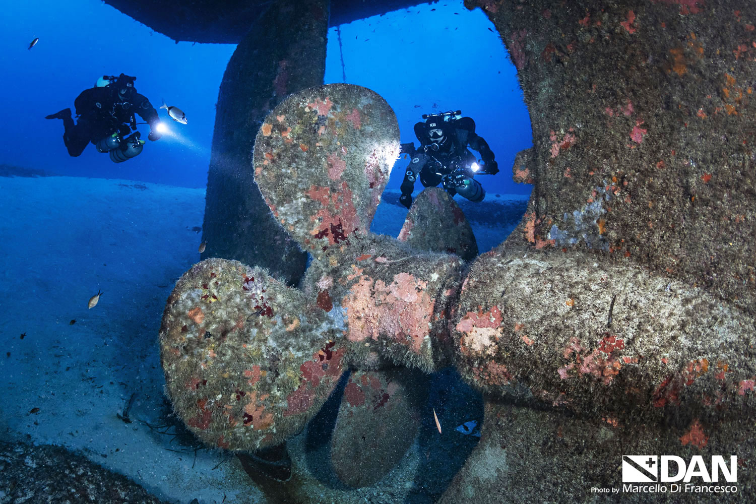
A deep technical/advanced profile focusing entirely on the massive stern at 34m. Divers drop straight to the sand to explore the towering 18-tonne bronze four-bladed propeller and the massive adjacent steering rudder.
Um El Faroud — Dive 3: Engine Room
An advanced penetration dive. Entry is through two large, open square hatches on the port side at 28m. The interior is a massive, multi-level cavern containing intact industrial pistons, valve arrays, and complex pipe runs.
Um El Faroud — Dive 4: The Split & Cargo Holds
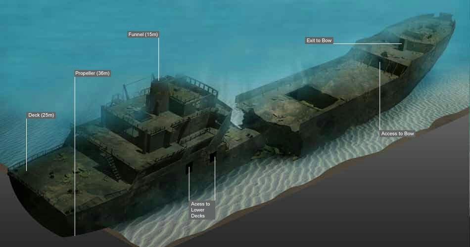
Focuses on the structural separation area caused by the 2005–2006 storms. Divers explore the vast open spaces of the forward bulk cargo holds (18–36m) and look through the dramatic physical cross-section where the sea split the ship apart.
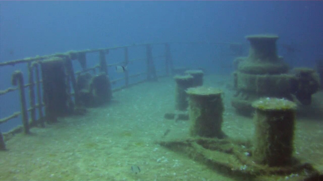
P29 Minesweeper
Built in 1969 in East Germany as the Boltenhagen, a Kondor-class minesweeper. Acquired by the Armed Forces of Malta in the 1970s, renamed P29, and utilized as a patrol boat for maritime border security. Decommissioned and deliberately scuttled on August 14, 2007, to create a premier artificial reef site.
Points of Entry & Exploration PathsSuperstructure begins at 22m. The bridge and wheelhouse sit at 18–26m. Multiple spacious interior passageways open up from 20–30m, cleared of hazards with overhead light slots cut into the decking. The bow rests on the sand at 30–34m.
Points of Interest & Unique FactsIt is the largest deliberately scuttled warship in Maltese waters. It uniquely retains its deck-mounted machine guns (both forward and aft gun mounts remain fully intact), which is incredibly rare for a Mediterranean dive wreck. The top mast broke off during heavy winter storms around 2022.
Marine Life NotesScorpionfish have heavily colonised the dark, metal corners of the wheelhouse. Octopus and schools of sea bream are frequently observed navigating the open gun placements and interior decks.
MV Rozi
Built in 1958 in Bristol by Charles Hill & Sons Ltd as a compact steel tugboat named MV Rossmore. Renamed MV Rossgarth in 1969 under new ownership. Brought to Malta in 1981 and renamed MV Rozi, where it operated as a working harbour tug in Grand Harbour. Deliberately scuttled upright on September 10, 1992, by Captain Morgan Cruises as an underwater attraction for tourist submarine safaris.
Points of Entry & Exploration PathsSuperstructure, upper deck, and railings span 15–22m. The largely intact bridge/wheelhouse is located at 20–26m. Interior penetration into the engine room is possible at 22–28m via wide port-side openings. The bow rests at 28–34m.
Points of Interest & Unique FactsThe engine and propeller were entirely stripped out before scuttling, leaving a very spacious, cleanly accessible interior passage. Over 30 years underwater has turned it into one of Malta's most densely populated artificial reefs, blanketed in sponges and gorgonian fans.
Marine Life NotesResident moray eels patrol the empty engine room casing. Large groupers shelter inside the bridge cabins, accompanied by schools of barracuda, octopus, and scorpionfish. Spectacular late-summer bioluminescence makes it a legendary night dive.